 By Bob Currie, Recreational Boating Safety Specialist
U. S. Coast Guard Auxiliary Station Galveston Flotilla
Being on cloud nine is a euphemism for being ecstatic or extremely happy. It is a good emotional state to be in. We also talk about people having their head in the clouds, but the meaning of that phrase has a somewhat negative connotation in that it means you are not paying attention to your surroundings or that you are lost in thought. As a sailor you should keep one eye on the clouds, because they can signify good weather, bad weather or changing weather. This column will discuss the general types of clouds that may be found at sea and what they mean to a sailor. A good sea voyage is one where you get home safely, and that alone can put you on Cloud 9.
The Station Galveston Flotilla of the US Coast Guard Auxiliary operates out of the USCG Station Galveston base on Galveston Island. They aid the Coast Guard by providing maritime observation patrols in Galveston Bay; by providing recreational boating vessel safety checks; and by working alongside Coast Guard members in maritime accident investigation, small boat training, providing a safety zone, Aids to Navigation verification, in the galley, on the Coast Guard Drone Team and watch standing.
Cloud Classification
Clouds are classified according to their shape and where they may be found in the atmosphere. The names given the different clouds are based on their shape and location in the atmosphere, and a third distinction, nimbus, indicates a cloud that is producing rain. Don’t confuse nimbus clouds with the Nimbus 2000 racing broom used by Harry Potter when he joined the Gryffindor Quidditch Team as their seeker.
The three general classifications according to where they are found are:
- Low clouds (cumulus, stratus, cumulonimbus, stratocumulus);
- Middle clouds (altocumulus, altostratus, nimbostratus); and
- High clouds (cirrus, cirrocumulus, cirrostratus)
The three general classifications according to their shape are:
- Cumulus (heap clouds, cottonball-like)
- Stratus (sheet clouds)
- Cirrus (fibrous clouds)
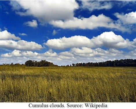
Cloud 1: Cumulus
The name derives from the Latin cumulo, which means heaps or piles. Cumulus clouds are fair weather clouds that form on sunny days. They generally have flat bases and cottonball-like tops. Rain associated with cumulus clouds is generally very light. Cumulus-shaped clouds may be found at all three levels, but the ones found in the low cloud level are just called cumulus. Cumulus clouds are often precursors of other types of clouds. They are formed as air warmed by the surface begins to rise. As the air rises, the temperature drops, causing the relative humidity to rise. This phenomenon is called atmospheric convection. As the upward convection continues, water vapor condenses, forming the characteristic flat-bottomed puffy shape associated with cumulus clouds.
Forecast: Cumulus clouds usually indicate fair weather. As cumulus clouds begin growing upward, they can form tall towers of cottonballs, called towering cumulus. Towering cumulus are associated with rain, but usually not heavy rain.
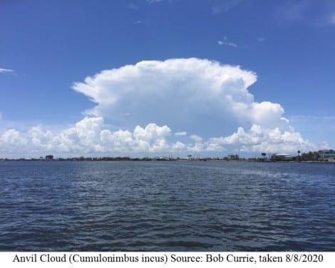
Cloud 2: Cumulonimbus
We already said nimbus means rain. Cumulonimbus is a dense, towering vertical cloud, formed from water vapor carried by powerful upward air currents. These clouds are capable of producing lightning and other dangerous severe weather such as tornadoes and large hail. Cumulonimbus clouds progress from overdeveloped towering cumulus, and may further develop as part of a supercell. Another distinct form of cumulonimbus cloud is known as an anvil cloud, or cumulonimbus incus (incus means anvil). It signifies a thunderstorm in its mature phase. I took this picture of an anvil cloud just this past Saturday (August 8) while on an Auxiliary patrol. We were in Offat’s Bayou at the time.
Forecast: Bad weather. A cumulonimbus cloud can advance from a simple cumulus cloud to a severe thunderstorm in as little as 30 minutes. This cloud is the reason you keep one eye to the sky. The average thunderstorm has a 15-mile diameter and a height of about 40,000 feet. An anvil cloud like the one pictured here generates many dangerous elements including lightning, hail, heavy rain, strong wind, and tornadoes. In addition to the large anvil formation you can also see some towering cumulus formations.
Cloud 3: Stratus
Stratus clouds are low level clouds characterized by horizontal layering with a uniform base. They are typically featureless clouds varying in color from dark gray to nearly white. They may produce a light drizzle or a small amount of snow. These clouds are essentially above-ground fog formed through the lifting of morning fog or by cold air moving at low altitudes.
Forecast: Light rain or drizzle. They typically form a weak warm front rather than the usual nimbostratus. There is no severe weather associated with stratus clouds.
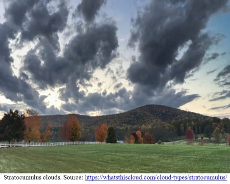
Cloud 4: Stratocumulus
Stratocumulus clouds, also called cumulostratus clouds, are characterized by large dark, rounded masses, usually in groups, lines or waves. They are a low level cloud that do not usually produce precipitation, but when they do it is only light rain or snow.
Forecast: Cloudy, but little if any rain. However, they are often seen at the front or tail end of worse weather, so they may indicate storms to come in the form of thunderheads or gusty winds.
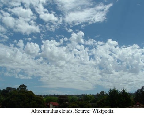
Cloud 5: Altocumulus
Altocumulus is a middle-altitude cloud. If you think of it as a cumulus cloud that’s just higher in the atmosphere, you will be on the right track. They are higher up in the atmosphere due to strong convection, that is, the upward movement of warm air. To help you gauge the difference between cumulus and altocumulus clouds, hold your arm out straight and point it to the clouds. If the cottonball shaped clouds are as big as your fist, then you are looking at cumulus clouds. If they are the size of your thumb, then you are looking at altocumulus clouds.
Forecast: As with cumulus clouds, there generally is no precipitation. However, altocumulus clouds can also form into towering altocumulus, and those clouds often signal the development of thunderstorms later in the day. Towering altocumulus is one of the three warning clouds, the other two being towering cumulus and cumulonimbus. The warning clouds found in the lower altitudes tend to signify more ominous bad weather than clouds at upper levels, but don’t overlook those higher clouds if you plan to be on the water for a while. They can sneak up on you.
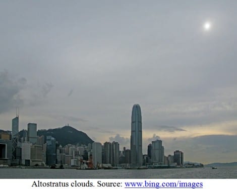
Cloud 6: Altostratus
Altostratus clouds are like stratus clouds but are formed higher up in the atmosphere. It is a featureless sheet of cloud but can be wavy as a result of wind shear through the cloud. They tend to form ahead of a warm front. The altostratus cloud gradually thickens into a rain bearing nimbostratus.
Forecast: No precipitation or very light precipitation but can thicken to form nimbostratus clouds with heavier precipitation. There is no severe weather associated with altostratus clouds.
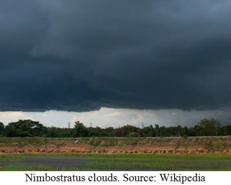
Cloud 7: Nimbostratus
Yep. It’s a rain cloud. A nimbostratus cloud is often dark, amorphous, and produces continuous precipitation (rain, snow or sleet) without lightning or thunder or heavy winds. The rain can last for many hours.
Forecast: Steady rain, snow or sleet. They do not produce severe weather though.
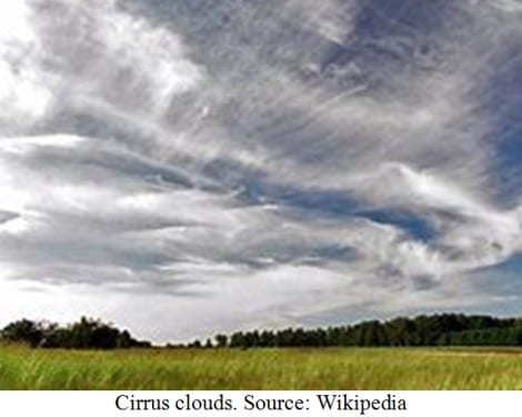
Cloud 8: Cirrus
Cirrus clouds are found in the high altitude portion of the atmosphere. They are thin wispy strands. Cirrus means ringlet or curling lock of hair. When they form distinctive tufts they are referred to as mare’s tails. Since they arrive in advance of a frontal system, they indicate that weather conditions may soon deteriorate. The moisture in these clouds is mostly ice crystals.
Forecast: No precipitation or extreme weather, but a large number of cirrus clouds can be a sign of an approaching frontal system or upper atmosphere disturbance. In the tropics a veil of white cirrus clouds approaches from the direction of a tropical cyclone about 36 hours prior to the arrival of the cyclone.
Cloud 9: Cirrocumulus
Cirrocumulus clouds, liked lower altitude altocumulus and cumulus clouds, signify convection. Although they can occasionally produce precipitation, they usually only form as part of a short-lived transitional phase within an area of cirrus clouds, but can also form as a result of the breaking up of part of a cumulonimbus anvil. They appear as white, patchy sheets with ripples or tufts without gray shading. The ripples are often organized in rows that form a herringbone pattern and are then referred to as mackerel sky.
Forecast: Rain in 8-10 hours. If the clouds are seen after a rain it usually means improving weather.

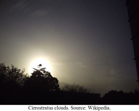
Cloud 10: Cirrostratus
Cirrostratus is a high-level, very thin, generally uniform stratus type of cloud. It is made out of ice crystals and it can make halos around the moon or sun. The sky looks milky. These clouds may form ahead of a weak front.
Forecast: Precipitation may follow in the next 12-24 hours.
Summary
Clouds have been used for centuries to predict the weather. While the Coast Guard recommends that you carry a marine FM/VHF radio with weather channels, they also recommend that you use weather forecasts prior to going out and keep an eye on the weather once you are out on the water. You can make certain predictions about the weather based on the shape of the clouds and their position in the sky. You should use this knowledge to enhance your safety on the sea, and head to port as soon as it becomes obvious that severe weather is approaching. Always have a plan B if you are cut off from your home port. Part of Plan B should be having enough fuel to make it to a different port.
For more information on boating safety, please visit the Official Website of the U.S. Coast Guard’s Boating Safety Division at www.uscgboating.org. Questions about the US Coast Guard Auxiliary or our free Vessel Safety Check program may be directed to me at [email protected]. SAFE BOATING!
[Aug-10-2020]
 Posted in