
- It sacrifices the Galveston Bay ecosystem and the economies and communities on Bolivar Peninsula and Galveston Island for the purpose of protecting the industrial areas and the communities in the northwestern part of the bay, but yet it does not provide adequate storm surge reduction in those areas, even showing increased flooding in some cases after the $31 billion gate is completed. And that is with storms that are weaker than those that have been hitting the US in recent years and will continue to do so.
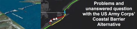
- The proposal to build 17 foot levees down highways 87 and 3005 will dramatically alter those communities, analyses have shown that there are 1,817 property parcels that directly intersect with the levees, almost twice as many as the US Army Corps estimated. And an additional 12,664 parcels (worth approximately $2 billion) on the floodside of the new levee, which will see increasing flooding, turbulence, and damage from even small storm surges
- What will happen to these homes left on the flood side of the levee? Will they be bought at fair market value? Bolivar and the West end have been built (at great expense by the homeowners) to stringent building standards designed to withstand flooding and storms and they will be put at increased risk due to the turbulence created by a levee structure directly behind their homes. This proposal will decrease the nonstructural resiliency that has been built in these areas following the devastation of Hurricane Ike.
- The proposed location highways 87 and 3005 in front of the levees will leave them open to increased scouring and damage from a storm surge, resulting in the potential for total lack of access following a storm.
- Will they be insurable if their flood risk is elevated due to the levees. Hal Needham an expert in storm surge levels and recurrence, has said that the height and energy of even small surges (less than 10 ft) will be increased due to the levees and cause much greater damage than if it was allowed to washover the peninsula and island naturally.
- What will happen to property values and economic development on the Bolivar Peninsula and Galveston Island?
- Bolivar property values have been estimated to be $1.2 billion, with a current rate of increase of $100 million per year.
- What will the loss of economic growth, investment, and tourism on the Bolivar Peninsula and Galveston Island mean for property tax and sales tax revenue?
- Who will pay for the non-federal portion of the $31 billion construction cost? Or the ongoing maintenance costs, which based on a standard industry estimate of 0.5% would be $155 million per year! Would Galveston County taxpayers have to cover a portion of that? How much?
- Where will the enormous amount of soil come from that will be required to build the levee structures along Bolivar and Galveston Island? What will the costs be? What will the transport mechanisms be?
- What will be the effect of changes to the hydrology of the Galveston Bay resulting from obstructing 30% of the flow? Changes in salinity and sediment distribution including erosion of salt marshes, have been observed in the Netherlands where sluice gates were built across the Eastern Scheldt estuary, reducing the productivity of the entire system.
- No project of this complexity and size has ever been built across a single coastal inlet in the world, the examples in the Netherlands on which it is based are separate structures on two different inlets and are located on dredge spoil islands and along a confined ¼ mile wide canal and are not used in concert as is proposed in the US Army Corps’ Coastal Barrier Plan. What if it fails? The Netherlands is much farther north and does not experience hurricanes or storms of the same intensity as the Gulf of Mexico.
- It is projected to take at least 15 years once construction starts, and won’t even be authorized before the mid 2020’s. We need protection for vulnerable communities sooner than that. What if it isn’t constructed in time for the next major hurricane?
- The changes in hydrology resulting from the Coastal Barrier gates will cause changes in sediment deposition and erosion, salinity, residence time, and productivity of the Galveston Bay Estuary, negatively affecting numerous endangered and threatened species, including shore birds, sea turtles, and marine mammals. As well as commercially important fish which move in and out of the bay throughout their lifecycles. What will happen to our commercial and recreational fisheries, to our quality of life?
- What will be the changes to the hydrodynamics of the ship channel when the opening is reduced by +30%, the pass is already hazardous for small and large crafts at flood or ebb tide and will only increase in velocity and discharge with the new gate structures. Will small crafts and sail boats even be able to navigate the opening? Will there be increased risk for large vessels and therefore increased risk of pollution from accidents resulting in spills of their cargo?
Informational Town Hall Meeting
US Army Corps’ Coastal Barrier Plan
Saturday, December 1, 1:00 pm
Other locally derived, more efficient, quicker to implement, and less costly coastal protection solutions are needed:
- The SSPEED Center Galveston Bay Park Plan would address the worst flooding risk in the northwestern part of the bay as well as the potential for pollution from the petrochemical plants in that area without the requirement of a massive Coastal Barrier Gate and Levee System.
- A detailed outline of the plan is available at the SSPEED Centers website
- The SSPEED Center Plan calls for a series of small gates and dredge spoil islands along the upper part of the Houston Ship channel, where it would protect the vulnerable communities along the northwestern bay as well as the petrochemical industry from a storm surge. It would be built using sediment dredged from the current channel and using gates that are within the size range of those that have been utilized and tested across the world.
- The first phase, which offers full surge protection, could be completed within 3 years instead of the 15 years estimated for the Coastal Barrier, so it has a chance to be in place before another major storm hits.
- It would have a much smaller impact on the hydrology and ecological functioning of the Galveston Bay ecosystem and includes wetland and oyster reefs as well as habitat creation for endangered shorebirds and sea turtles.
- It is estimated to cost up to $2.8 billion instead of the $23-31 billion of the Coastal Barrier.
- Even with the SSPEED Center plan, we would still need local solutions to increase protection and resiliency along the coast.
- These include raising evacuation routes on highways 87 and 3005 to 3-5 ft above current levels, to reduce flooding from high tides
- Renourishing beaches and dunes to slow the energy of surge and waves as it moves inland.
- Building levees and responsive flood solutions on the backside of Galveston Island as well as Texas A&M at Galveston on Pelican Island. These projects could be done much quicker and more cheaply if they are designed, permitted, and funded separately from the enormous $31 billion Coastal Barrier Project
- This approach allows for more rapid response and local solutions to coastal flooding which address the unique local needs of coastal communities like Bolivar Peninsula and Galveston Island.
- We all live at the coast for a reason, because we love it and they are proposing to drastically alter everything we love about living here.
- There are better alternatives we just need to muster the community and political will to seek them out and act in the best interest of all of our communities.
It is very important that the public voice their concerns during the public comment period, which ends January 9th 2019.
Please get informed at coastalstudy.texas.gov and make your voice heard by submitting a comment electronically or by mail or at the upcoming public meetings listed below.
Public comments can be:
Mailed to USACE, Galveston District, Attn: Ms. Jennifer Morgan, Environmental Compliance Branch, Regional Planning and Environmental Center, P.O. Box 1229, Galveston, TX 77553-1229;
Emailed to [email protected]. Comments must be postmarked by January 9, 2019.
At the Public Meetings noted below:
Upper Coast
Tuesday, 11-Dec | 5:30pm – 9:00pm
Winnie Community Building
335 South Park Street
Winnie, TX 77665
Wednesday, 12-Dec | 5:30pm – 9:00pm
Galveston Island Convention Center
5600 Seawall Blvd
Galveston, TX 77551
Saturday, 15-Dec | 1:00pm – 4:30pm
Crenshaw Elementary and Middle School
416 State Hwy 87
Crystal Beach, TX 77650
Tuesday, 18-Dec | 5:30pm – 9:00pm
Bay Area Community Center
5002 E NASA Parkway
Seabrook, TX 77586
 Posted in


My mother had a beach house on the east side of Crystal Beach. When Ike came it took the house away with a 20 foot storm serge. Glad she was not alive to see it. The point is, Boliver Pennisula is a great place to visit and /or live. The people are the best and the churches are wonderful. Loved going to Roll-over Pass. CANNOT BELIEVE IT IS GONE. NOW you want to take away Boliver. ……Someones pocket book is growing. Its all about money. Its always about money. So sad in Iowa.
Every one that has built between the ocean and Hwy 87 know the chances of a hurricane. We get that. We bought insurance. The problem we want fixed is the water over road at the curve! Yes, if their proposal goes thru, Bolivar will be no more. Which I think is what they are trying to do.
only a fool thinks they can out do mother nature
After calling the elected officials, I changed my approach. Today I composed a email letter addressing my concerns for the proposed alternatives offered by the Coastal Study. I went to each listed elected official’s websites and filled out their contact me form and copied and pasted it to all 9 listed on savebolivar.org.
I hope everyone will do the same and make them aware of the proposed alternatives negative impacts.
This plan proposed by the Corps is truly a death sentence for Bolivar Peninsula, this is a time for our Community to rally. Stay informed, attend meetings, send letters to our Officials, make your voices heard, join the public group on FB ” Coastal Spine Information Page”. Open the links provided where you will find interactive maps, Officials contact information and meeting dates times and places. Thank you all, Carlis Cole
J. Paul makes an excellent assessment of the situation. We have recently moved to Lufkin and do keep up with goings on through the online newspaper and the Beach Triton delivered to our home. The people of the Bolivar Peninsula certainly do have an uphill battle. If ever they unite, this is the time!
This proposal is insane; I thought the Ike dike purpose was to
protect properties from storm surge; probably 90
percent of properties on Bolivar are between beach
and highway 87; Galveston same issue; other questions
concern viability of
Galveston Bay; this scheme effectively destroys
the entire upper Texas coast eco system ; what politicians
support this idiotic proposal? how about Core of En.
moving the oil refineries further inland if the goal is
only to protect the oil business
This is an excellent summary. Very well done, Azure Bevington.